Why do ships from China pass through Kamchatka and not directly? – Russia today Posting in CHAT: Russia If you open an online map of the location of ships and look around Kamchatka, you will notice one very interesting feature. Most ships follow one of three routes: China - USA, USA - China, USA - South Korea. If you look at the map again after this, many will have a logical question: why do all these ships make such a detour, describing an arc across the ocean, if they could just sail here to catch. Most people know about this one way or another, but for obvious reasons they forget almost immediately after finishing their school geography course. The point, of course, is a distortion of the perception of real distances and locations of objects on our planet. The problem is the two-dimensionality of the map. The image of the Earth on a plane (sheet of paper) greatly distorts the described distances. The distortion increases as the planet moves away from the equator. Thus, the closer the map is to the poles, the more it stretches out. This is because our planet is not flat, but spherical. The easiest way to evaluate the strength of distortion when drawing flat maps in everyday conditions is to use a regular orange. Carefully cut off the peel of the fruit and try to flatten it. At its “poles” it will tear and diverge. Something similar happens when you try to transfer an image of the planet’s surface onto a flat map. In this case, not only the distances and sizes of objects on the map are distorted, but also their location. Just compare a regular map of the earth and how the continents “lie” on it with how they look on the globe. Here lies the answer to the question why many ships from China to the USA sail through Kamchatka. In fact, they are simply following the shortest path. Because the closer to the pole, the shorter the distance. On the map, the direct route from Asia to America along the equator appears to us as a straight line. However, on the globe this is not a straight line, but a curve. Moreover, on the globe, America lies noticeably further from Asia along the equator than it seems to us on the map. The same applies not only to ships, but also to airplanes. Source link Source link
от
bonabo
10189
от
bonabo
9280
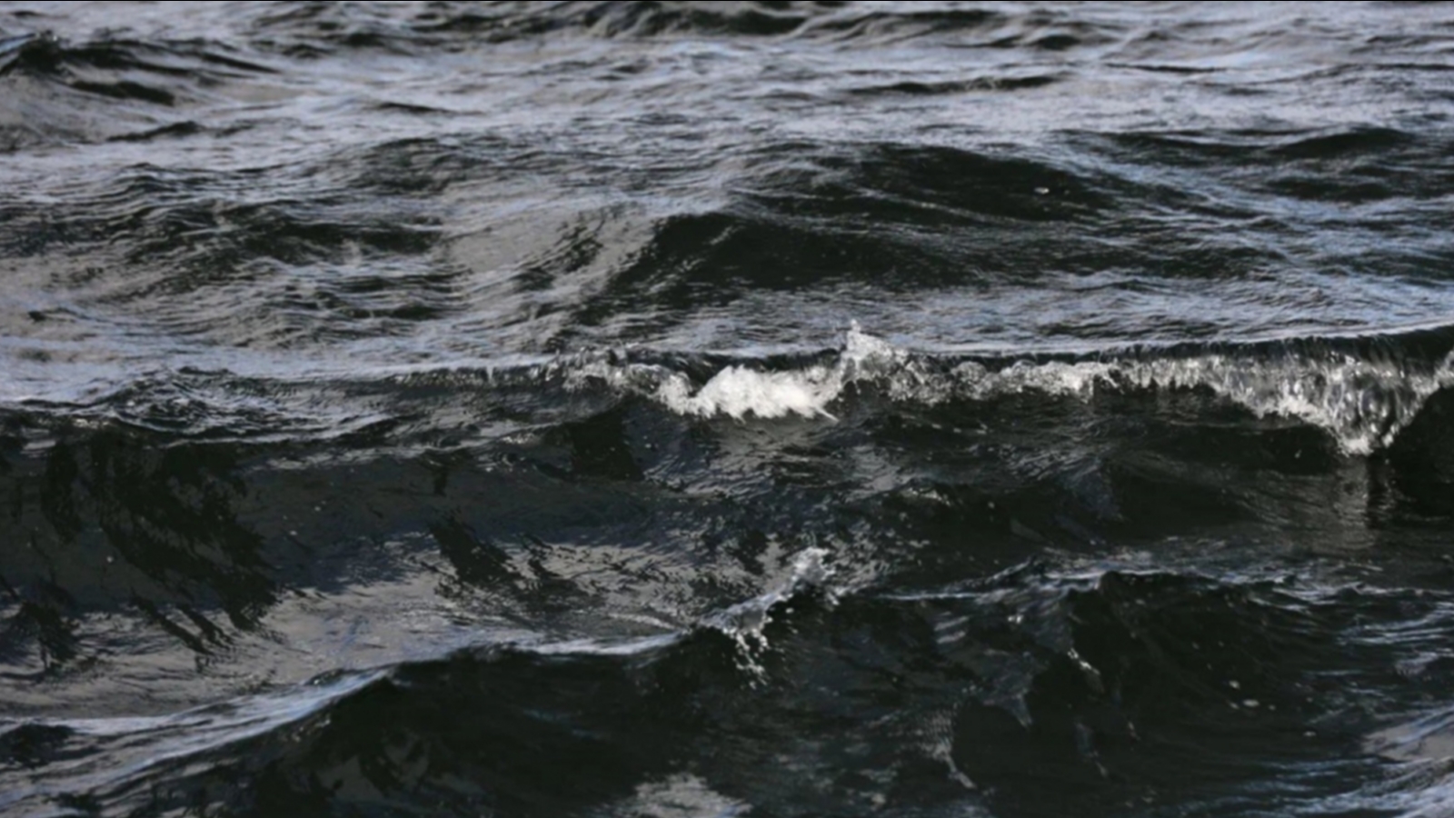
In Teriberka, ships will be prohibited from going to sea – Russia today Posting in CHAT: Russia News | 08 05 2024, 17:10 | SeverPost Photo: SeverPost/Alexander Loginov In Teriberka, restrictions will be introduced on the entry of small vessels into the Barents Sea. This was reported by the regional department of civil defense and emergency situations. The department explained that the restriction was introduced due to unfavorable weather conditions. It will be in effect from midnight May 9 until midnight May 11. Let us remind you that the northerners showed the condition of the road to Teriberka on video. Read also: Road repairs have begun at Festivalnaya in Murmansk To be the first to know about the main news and the most important events of the day, subscribe to our Telegram channel. Source link Source link
от
bonabo
9583
The port city of Taganrog continues to receive cruise ships – Russia today Posting in CHAT: Russia From June to September, four cruise ships with 8 hundred tourists on board will moor at the Taganrog pier: Konstantin Fedin, Sergey Kuchkin, Alexander Radishchev and Kronstadt. “After the construction of a floating place in the port city of Taganrog, the opportunity arose to create cruise lines with access to the sea. Previously, tourists were transported to the seaside city by buses from Rostov,” reports the telegram channel “Molot” with reference to the press service of the Vodokhod company. In 2023, three cruise ships called at the port of Taganrog, carrying 382 people. Read us on Telegram: https://t.me/bloknot_taganrog Irina Kuznetsova Previously reported: Today Tatyana Nikolaevna Konevskaya celebrates her birthday birthday 2030 News about Bloknot-Taganrog Source link Source link
